
On the night of 25 August 2017, Hurricane Harvey made landfall on the middle Texas coast as a Category 4 storm, and its eye passed over the Rockport and Fulton area. For hours the towns took sustained hurricane winds, with stronger gusts tearing at roofs, trees and boats. Afterward the storm stalled inland and brought historic flooding to the Houston region, which is how many people outside Texas remember it. Here, on the Coastal Bend, Harvey is remembered for the wind.
This story is told plainly, for visitors who want to understand the place they are walking through. It is not a catalogue of damage, and the people who lived through it deserve better than that. It is a short account of what happened, how the towns rebuilt, and how to travel sensibly in storm season.
The night the storm came in
Harvey strengthened quickly over the warm Gulf in the days before landfall. Officials urged people in the coastal towns to leave, and many did. Those who stayed described a long night of roaring wind, breaking glass and failing power. By morning, much of Rockport and Fulton was unrecognisable: roofs gone, walls opened, power lines down across roads and boats tossed together in the marinas.
The live oaks, so much a part of the landscape here, were stripped of leaves and many lost limbs. Some that had stood for generations came down. Yet a great many survived, including the ancient oak at Goose Island State Park, which is described in the guide to Goose Island and the Big Tree.
Clearing up and starting again
Recovery took years rather than months. The first weeks were about clearing roads, restoring power and water, and finding shelter for people whose homes could not be lived in. Volunteers, crews and neighbours worked side by side. Debris piles lined the streets for a long time, and blue tarps covered roofs across both towns.
Rebuilding followed in stages. Some families returned to repaired homes; others sold or left. Businesses reopened one at a time. Public places, including the beach park, the harbour and the art centre, were repaired or rebuilt, often to stronger standards than before. Newer houses along the water now tend to stand higher on their pilings.
Down the road · By trailerHurricane season, red tide and Gulf weatherOld buildings that came through
Not everything was lost. A number of older buildings in Rockport rode out the storm with damage that could be repaired, and their survival meant a lot to a town trying to hold on to its character. Wooden houses from the late 1800s, with their porches and steep roofs, still stand on the older streets.
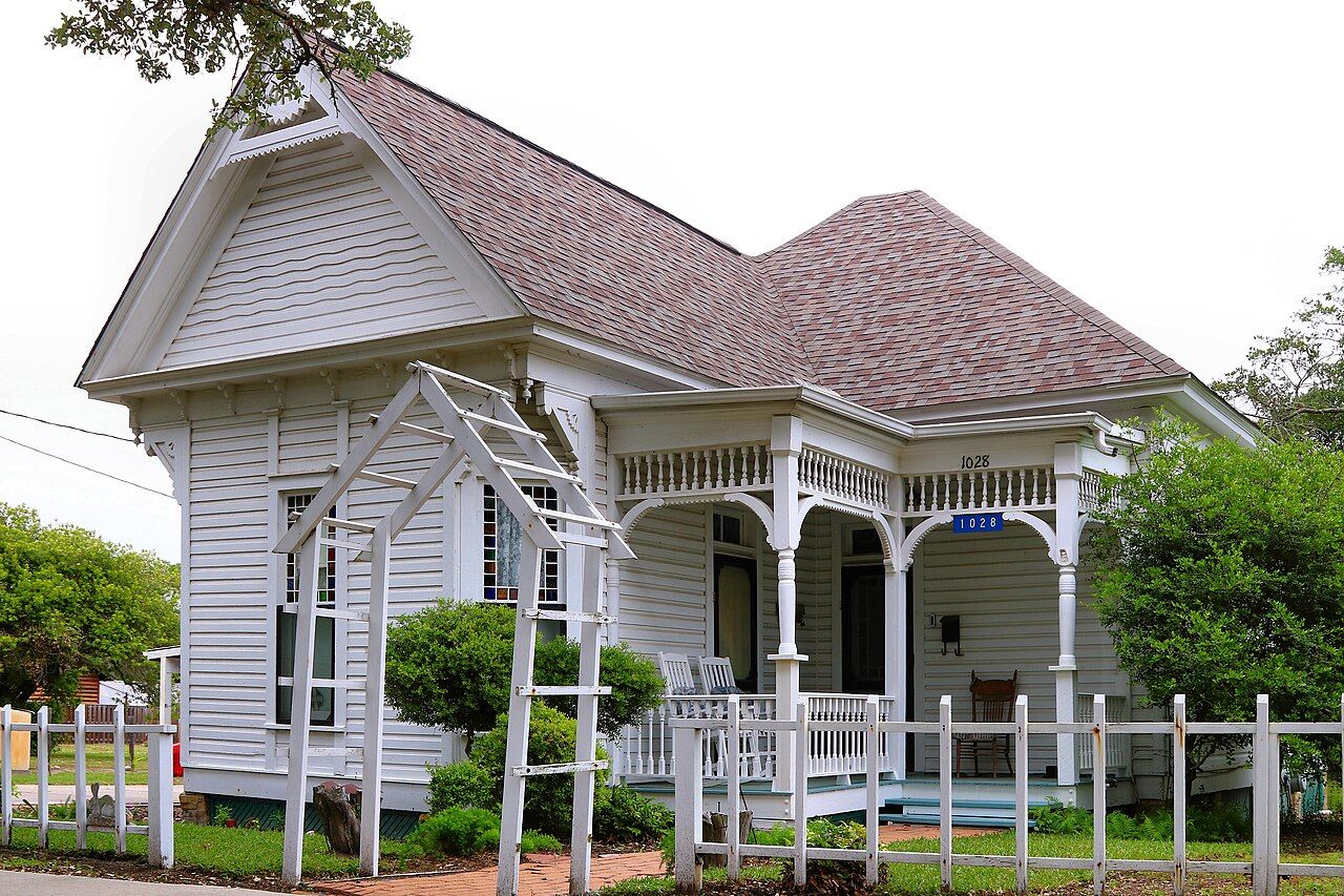
Walking these streets, you see a mix of the old, the repaired and the brand new. A restored Victorian cottage may stand next to an empty lot, and a fresh house on stilts may sit beside an oak still missing half its crown. None of it is staged for visitors. It is simply what a recovering town looks like.
How the towns look now
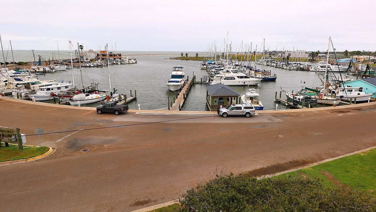
Years on, most visitors would not guess the scale of what happened without being told. The harbours are busy again, the galleries are open, and the beach park fills on warm weekends. The marina, rebuilt and lined with boats, looks much as a working Texas harbour should. The guide to Rockport's harbour, beach and art galleries shows what a day in town looks like today.
The landscape has healed in its own way. Oaks that looked dead in the autumn of 2017 pushed out new leaves the following spring, often in dense tufts along the trunk and main limbs. Marsh grasses grew back along the bay edges, and the birds that make this coast famous returned on schedule each winter and spring, as if nothing had happened at all.
Look a little closer and the story is still there. Some trees have a lopsided shape from lost limbs. Some lots stand empty where houses once were. Locals may mention the storm in passing, as a marker of time: before Harvey, after Harvey. Listen, but leave it to them to raise the subject.
Storm-season sense for visitors
The Atlantic hurricane season runs from June to November, with the busiest weeks usually in late summer and early autumn. Most visits pass without trouble, but it pays to travel with a plan.
- Follow official forecasts and the guidance of local emergency managers, not rumours on social media.
- Know your evacuation route inland before you need it. Highway 35 and the roads north and west are the usual ways out.
- If an evacuation is ordered, leave early. Roads clog quickly, and fuel can run short.
- Travelling with a trailer or motorhome makes early departure even more important, since high winds make towing dangerous.
- After a storm, stay away from downed lines and flooded roads, and give crews room to work.
Low bayfront roads, including parts of Fulton Beach Road, flood first when water is pushed into the bays. Even a tropical storm well offshore can raise water levels and make some routes impassable.
Part of the recovery
Coming to Rockport now is, in its own small way, part of the recovery. Visitors fill tables, buy art, walk the shore and bring the towns back to the rhythm they had before. Be curious, be respectful, and remember that behind every rebuilt porch is someone who did a great deal of work to stay.
The cooler months, from October to May, are the easiest time to visit and the furthest from storm season. Whooping cranes winter nearby, as the story of whooping cranes at Aransas describes, and the bays are at their calmest in the mornings.
Picture credits: Larry D. Moore – Creative Commons BY 4.0; Larry D. Moore – Creative Commons BY 4.0.